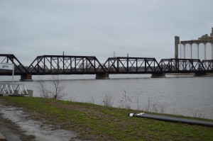
Water levels on the Cedar River rise in northwest Cedar Rapids as rain continues to fall last month. A flash flood warning was issued for Eastern Iowa on May 26, 2013. (photo/Cindy Hadish)
The National Weather Service issued the following on Sunday, May 26, 2013:
A Flash Flood Warning remains in effect until 1:45 am CDT for Southwestern Cedar, Southern Benton, Iowa, Johnson, Southwestern Linn and Northwestern Muscatine counties. At 7:57 pm CDT, National Weather Service Doppler radar indicated that the heavy rain producing thunderstorms have moved out of the area. However, widespread flooding of streams, creeks and roadways will persist for a while despite the heavy rain having ended. Additional showers and thunderstorms with heavy rain developing over Northwest Iowa may develop or move back into the warned area late this evening and overnight. If this were to occur, then a renewed round of flash flooding can be expected with the ground saturated from the recent heavy rain.
Locations in the warning include but are not limited to Swisher, Solon, Shueyville, Oxford, North Liberty, Lake Macbride State Park, Marengo, Ladora, Conroy, Amana, Ely, Walford, Norway, Luzerne, Blairstown and Belle Plaine.
Recommended actions
Do not drive on flooded roads. Most fatalities occur in vehicles Swept away in flood waters as shallow as 1 foot.
Flooding of small streams and creeks, highways and streets. Underpasses and low lying urban and rural areas is likely.
If you are camping near a stream, creek or other low lying area. Move immediately to higher ground.
Please report any flooding or damage to your local law enforcement agency for relay to the National Weather Service.

No Comments Yet